| Hellenic Trench | |
|---|---|
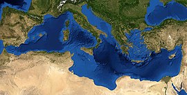
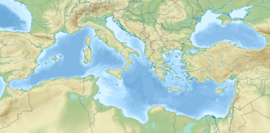
 Bathymetric view of the Mediterranean. The light blue region between mainland Greece and Anatolia represents the Aegean Sea and most of the Aegean Plate on which it is situated. These waters are relatively shallow. The southern margin is occupied by the Hellenic arc, a range of mountains and islands. Parallel to its southern edge is the deep-water Hellenic Trench, at the bottom of which is the line of subduction, a convergent consuming boundary, which is gradually pushed to the south by back-arc extension. | |
| Etymology | Republic of Hellas (Greece) |
| Location | Off the south coast of Crete is at about the center of the trench's arc |
| Coordinates | 34°45′10.5″N 24°52′15.3″E / 34.752917°N 24.870917°E |
| Country | Greece |
| Region | Southern margin of the Aegean Sea |
| Characteristics | |
| Length | ESE leg, or Hellenic Trench proper, 600 kilometres (370 mi); ENE leg, HT by analogy, 400 kilometres (250 mi) |
| Strike | ESE Cephallenia to Crete, ENE Crete to Rhodes. |
| Dip | ESE leg average 35° to the NE ENE leg average 50°, either side |
| Tectonics | |
| Type | The ESE leg is mainly reverse dip-slip. The ENE leg is mainly strike-slip or oblique. |

The Hellenic Trench (HT) is an oceanic trough located in the forearc of the Hellenic Arc, an arcuate archipelago on the southern margin of the Aegean Sea Plate, or Aegean Plate, also called Aegea, the basement of the Aegean Sea. The HT begins in the Ionian Sea near the mouth of the Gulf of Corinth and curves to the south, following the margin of the Aegean Sea. It passes close to the south shore of Crete and ends near the island of Rhodes just offshore Anatolia.[2]
In the classical theory of its origin the HT is an oceanic trench containing the Hellenic subduction zone, directly related to the subduction of the African Plate under the Eurasian Plate. Alternate views developed later on additional data question the classical view postulating that the HT may be the result wholly or partially of back-arc extension and slab rollback. The "partial" view hypothesizes that the western leg of the HT, Ionian Sea east to eastern Crete, exhibits the line of subduction and therefore is an oceanic trench.[3] The "not at all" view, relying on the theory that the subduction line is under or south of the Mediterranean Ridge, questions whether any of the HT is currently subductional.[4] If not, it is merely a legacy, a remnant of a previous subduction zone that has gone elsewhere.[a]
North of this subduction the Adriatic or Apulian Plate subducts under the Balkans. More recently and rarely the terms "North Hellenic Subduction" and "North Hellenic Trench" have been applied there, rendering the HT and HS into the "South HT" and "South HS."[5] The distinction is based on a differentation of North Hellenides from South Hellenides. The dividing feature is the Gulfs of Patras and Corinth. From their vicinity and southward an extensional regime prevails, while the north remains in a compressional. The Hellenides are the mountains of Greece, divided into an inner and outer range. The extensional regime cuts across them transversely, producing four quarters. The South Hellenic Subduction Zone, and the Hellenic Trench, if different (many still consider them not to be so) are located in the southern outer Hellenides.
Meanwhile, the deep basins of the Trench and their marine ecologies are the homes of a number of marine mammals, such as Cetaceans, some of which are endangered species threatened by maritime traffic in the Eastern Mediterranean.
The study of the overall features of the surface of the Earth has been the concern of plate tectonics since the Plate Tectonics Revolution of the 1970s. It was a development of the continental drift theory of Alfred Wegener. These features are often called lineaments. The Hellenic Trench along with the Hellenic Arc and other related features are lineaments important to the geology primarily of Greece and secondarily of Turkey.
Morphology or geomorphology studies the "shapes" (morphai) of the lineaments, while kinesiology studies their "motions" (kineseis). Both topics as used typically in geology articles do not go beyond plane geometry, trigonometry, elementary algebra, and elementary statistics, which are taught at the high school level. More daunting are the geologic special terms, which are numerous, and continue to be innovated. This article assumes basic knowledge of mathematics and science, but includes parenthetical clues as to the meaning of the special terms as well as links to articles explaining them.
- ^ Tudela, Sergi; Simard, François (2004). The Mediterranean Deep-sea Ecosystems: An Overview of Their Diversity, Structure, Functioning and Anthropogenic Impacts, with a Proposal for Their Conservation. Malaga, Spain: IUCN. ISBN 978-2-8317-0846-1.
- ^ Sheppard, Charles, ed. (2018). World Seas: An Environmental Evaluation. Vol. I: Europe, The Americas and West Africa (2nd ed.). London: Academic Press. p. 227. ISBN 978-0-12-805068-2.
The Hellenic Trench is a major element in the seafloor morphology of the Hellenic Seas. It extends from the northern Ionian Sea to south of Crete in the Libyan Sea to the Rhodes Basin in the Levantine Sea and hosts the deepest basins and troughs of the Mediterranean Sea
- ^ A.D. Ansell; R.N. Gibson; Margaret Barnes, eds. (1997). Oceanography And Marine Biology. Annual Review, Volume 35. CRC Press. p. 439. ISBN 978-0-203-50172-6.
The Hellenic part of the Ionian Sea (Eastern Ionian Sea) is characterized by the existence of the deep Hellenic Trench, lying along the western and southwestern Hellenic coast, and the islands of the Cretan Arc (Fig. 3). At the Hellenic Trench, the depths generally exceed 4000m, with a maximum depth of 5121m, just southwest of Peloponnisos ..., which is also the maximum depth of the entire Mediterranean Sea.
- ^ Meier, T.; et al. (2007). "A model for the Hellenic subduction zone in the area of Crete based on seismological investigations". In Taymaz, T.; Yilmaz, Y.; Dilek, Y. (eds.). The Geodynamics of the Aegean and Anatolia. Geological Society, Special Publications 291. Vol. 291. p. 184. doi:10.1144/SP291.9. ISBN 9781862392397. S2CID 129674811.
The widely used term 'Hellenic Trench' commonly used to refer to the distinct topographic feature marking the site where the subducted plate disappears beneath the forearc at a convergent plate boundary may be misleading here.
- ^ Royden & Papanikolaou 2011, p. 3
Cite error: There are <ref group=lower-alpha> tags or {{efn}} templates on this page, but the references will not show without a {{reflist|group=lower-alpha}} template or {{notelist}} template (see the help page).


